 Download catalog
 Technical support
 Check your order
 Tiếng Việt
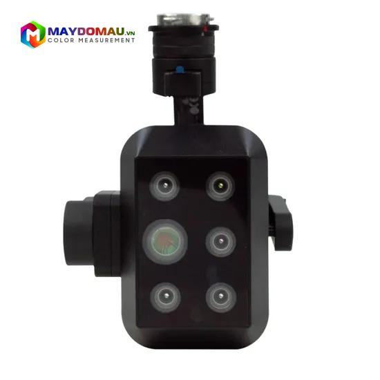
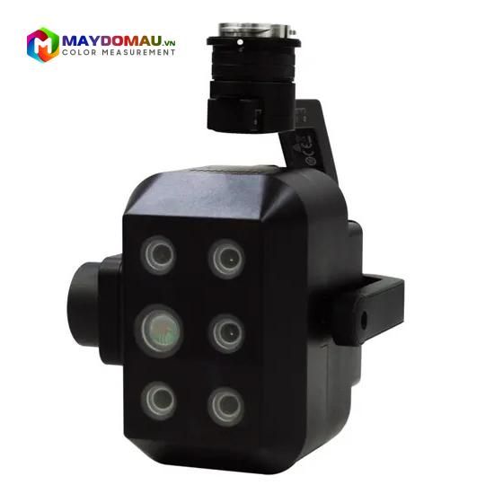
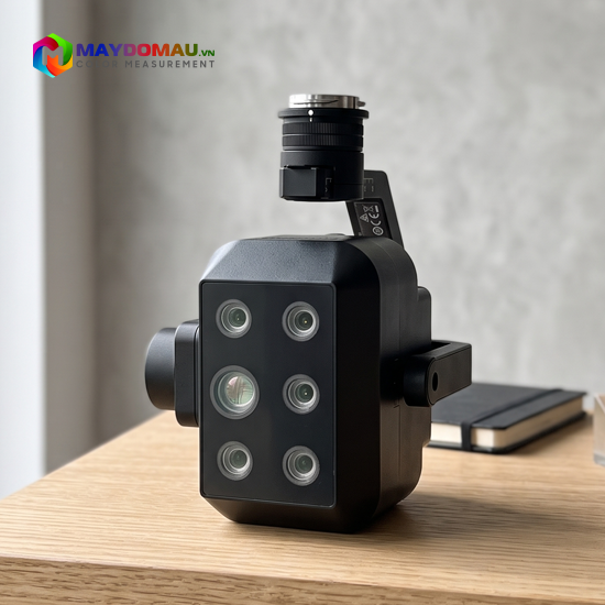
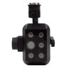
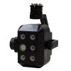
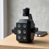
CHN SPEC FS-500 Multispectral Camera (4 multispectral bands + 1 RGB)
Contact
SKU: FS-500
Origin: China




Product Details
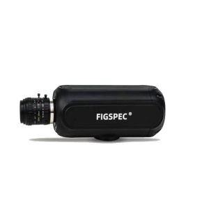
CHN SPEC FS-500 Multispectral Camera (4 multispectral bands + 1 RGB)
The CHN SPEC FS-500 Multispectral Camera is a comprehensive and flexible aerial data acquisition solution. With an integrated structure of 4 dedicated multispectral sensor bands and 1 high-resolution RGB color imaging band, the FS-500 allows users to both map real terrain and deeply analyze vegetation health indices in just a single flight. This is an ideal device for smart agriculture projects and large-scale environmental resource management.
Outstanding Features
Comprehensive “5-in-1” sensor system: The camera is equipped with 5 independent signal receiving lenses:
- 1 RGB Band: Provides high-resolution true-color imagery for visual observation, Orthomosaic mapping, and 3D terrain modeling.
- 4 Multispectral Bands: Typically includes core wavebands: Green, Red, Red Edge, and Near Infrared (NIR). These are the most important wavebands for calculating standard vegetation indices (such as NDVI, NDRE).
- Global Shutter synchronization: The multispectral sensors use Global Shutter technology and have absolute synchronized trigger times. This helps eliminate image distortion when the Drone flies at high speeds, ensuring the RGB and multispectral data layers can be accurately superimposed.
Smart Downwelling Light Sensor (DLS): The FS-500 comes with a DLS (Downwelling Light Sensor) module mounted on top of the Drone to measure solar radiation in real-time. The system automatically compensates for changes in ambient light (such as cloud cover), ensuring the collected spectral reflectance is always accurate and consistent across different flight times.
Integrated accurate positioning (RTK/GPS): The device can synchronize coordinate data directly from the Drone’s GPS or RTK system, Geotagging with centimeter-level accuracy directly into the image’s metadata (EXIF/Metadata), helping to minimize post-processing time.
Ultra-compact and lightweight design: Minimal weight and a compact size make the FS-500 easy to install (plug-and-play) on most drone frames (from Multirotors to Fixed-wings) without significantly impacting flight time.
Technical Specifications:
Combination method: 4 multispectral bands + 1 RGB
Sensor size: Multispectral: 1/2″; RGB: 1/3″
Effective pixels: Multispectral: 1.3 Mpx; RGB: 11.9 Mpx
Shutter type: Multispectral: Global shutter; RGB: Rolling shutter
Digital resolution: Multispectral: 12-bit; RGB: 8-bit
Field of View (FOV): Multispectral: 54.2°×44.5°; RGB: 49.1°×40.5°
Ground Sample Distance (GSD): Multispectral: 9.6 cm @ H120m; RGB: 2.86 cm @ H120m
Coverage width: Multispectral: 123m×98m @ H120m, RGB: 109m×88m @ H120m
Spectral bands: 555nm@27nm, 660nm@22nm, 720nm@10nm, 840nm@30nm, RGB
Optical window: Sapphire optical glass
Device dimensions: 182mm × 169mm × 129mm (including gimbal)
Weight: ≤940g (including gimbal)
Mount interface: X-Port
Power supply: X-Port
Power consumption: 43W
Image format: Multispectral: 16-bit TIFF (including GPS); RGB: 8-bit JPEG (including GPS)
Storage: Standard 512GB SSD
Processing software: FigSpec UAV-MS, FigSpec Merge-MS, FigSpec Studio
Parameter settings: DJI Pilot
Capture trigger: Timer capture
Capture frequency: Supports up to 10Hz
Operating temperature: -10°C to +50°C (wind speed ≥1m/s)
Storage temperature: -30°C to +70°C
Ambient humidity: RH ≤ 85% (non-condensing)
Practical Applications
Thanks to the combination of crisp RGB imagery and core multispectral data, the CHN SPEC FS-500 is a powerful tool in:
- Precision Agriculture: Mapping NDVI to assess crop density and health, early detection of areas with pests, water stress, or nutrient deficiencies (especially thanks to the Red Edge band), thereby optimizing fertilizer and pesticide application.
- Mapping and Topographical Surveying: Using high-resolution RGB images to create basemaps and Digital Surface Models (DSM) for farm areas, plantations, or construction sites.
- Forestry and Plant Protection: Evaluating forest canopy cover, classifying different crop types, and monitoring the rate of ecological recovery after natural disasters or wildfires.
- Scientific Research & Environment: Monitoring water quality, tracking algae growth in lakes and ponds, and inspecting large-scale ecological fluctuations.
Reviews (4)
No comments yet
Related products
- SKU: FS-19M
- Origin: China
- SKU: FS-620
- Origin: China
- SKU: FS-IQ-A
- Origin: China
- SKU: FS-IQ-VIS
- Origin: China
- SKU: FS-IQ-SWIR
- Origin: China
- SKU: FS-IQ-VISNIR
- Origin: China
Bạn vui lòng nhập đúng số điện thoại để chúng tôi sẽ gọi xác nhận đơn hàng trước khi giao hàng. Xin cảm ơn!
anhthu_97
Máy chạy ổn định, gắn lên flycam nhẹ tênh, chụp đa phổ rõ nét. Dùng cho nông nghiệp thấy rất ổn, đáng tiền. Sẽ ủng hộ tiếp!
duchuy2001
Camera này xài cho drone bay quét đồng ruộng thấy ổn áp lắm, dữ liệu đa phổ rõ nét, phân tích đất với cây trồng siêu chuẩn 😍 Mua về không thất vọng!
Nguyễn Đức Vũ
Camera dùng ổn cho khảo sát nông nghiệp, ảnh RGB và đa phổ tiện phân tích. Tuy nhiên cần thời gian làm quen xử lý dữ liệu, hướng dẫn nên chi tiết hơn.
Nguyễn Thùy Trang
Cam CHN SPEC FS-500 xịn đét nha. Gắn máy bay phân tích thổ nhưỡng với lập bản đồ sinh thái cực chuẩn. 4 kênh đa phổ với RGB quá ngon 👍