 Download catalog
 Technical support
 Check your order
 Tiếng Việt
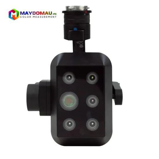
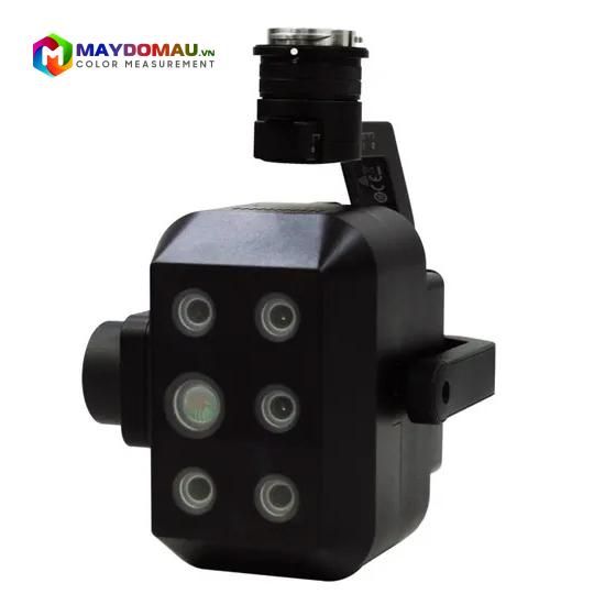
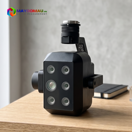
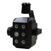

CHN SPEC FS-620 Multispectral Camera (4 Multispectral bands + 1 RGB + 1 Thermal Infrared (LWIR) band)
Contact
SKU: FS-620
Origin: China




Product Details
CHN SPEC FS-620 Multispectral Camera (4 Multispectral bands + 1 RGB + 1 Thermal Infrared (LWIR) band)
The CHN SPEC FS-620 multispectral camera is a breakthrough spatial data acquisition solution. By combining the power of 4 multispectral bands, 1 high-resolution RGB optical lens, and 1 thermal infrared (LWIR) sensor into a single module, the CHN SPEC FS-620 provides comprehensive analytical capabilities. This device allows users to observe visual details visible to the naked eye, assess vegetation health via spectral indices, and map temperature distribution in just a single flight.
Outstanding Features of CHN SPEC FS-620
Superior “6-in-1” sensor system: The device simultaneously collects data through 6 independent lenses:
- 1 RGB Band: Provides high-resolution true-color imagery for visual mapping and 3D modeling (Photogrammetry).
- 4 Multispectral Bands: Typically including Green, Red, Red Edge, and Near Infrared (NIR) bands for detailed analysis of crop biological indices (such as NDVI, NDRE).
- 1 Radiometric Thermal Infrared (LWIR) Band: Measures and maps absolute surface temperatures, detecting areas with thermal anomalies.
Perfect image synchronization: All 6 sensors are time-synchronized to trigger captures simultaneously. This ensures that the optical, multispectral, and thermal image layers can be superimposed with absolute precision during post-processing.
Integrated Downwelling Light Sensor (DLS): The FS-620 typically comes with an upward-facing light sensor module to record ambient lighting conditions throughout the flight. This data enables automatic reflectance calibration, ensuring spectral data remains accurate regardless of shadows or cloud cover.
Ultra-lightweight design, optimized for UAVs: With its light weight and streamlined aerodynamic design, the camera is easily mounted on most current commercial and industrial drones without significantly reducing flight time.
Diverse connection protocols: The device supports a variety of standard connection interfaces (such as SkyPort, PWM, Serial, Ethernet), allowing deep integration into the flight control system to receive GPS/RTK coordinates and trigger automatic image capture along the flight path.
Technical Specifications:
Combination method: 4 multispectral bands + 1 RGB + 1 thermal infrared band (LWIR)
Sensor size: Multispectral: 1/2″; RGB: 1/3″
Effective pixels: Multispectral: 1.3Mpx; RGB: 11.9Mpx; LWIR: 0.3Mpx
Shutter type: Multispectral: Global shutter; RGB: Rolling shutter
Digital resolution: Multispectral: 12-bit; RGB: 8-bit
Field of View (FOV): Multispectral: 54.2°×44.5°; RGB: 49.1°×40.5°
Ground Sample Distance (GSD): Multispectral: 9.6 cm @ H120m; RGB: 2.86 cm @ H120m
Coverage width: Multispectral: 123 m × 98 m @ H120m; RGB: 109 m × 88 m @ H120m
Spectral bands:
Multispectral: 555nm@27nm, 660nm@22nm, 720nm@18nm, 840nm@30nm
RGB, LWIR: 8μm–14μm (Long-wave infrared band)
Optical window: Sapphire optical glass
Device dimensions: 182mm x 169mm x 129mm (including gimbal)
Weight: ≤1000g (including gimbal)
Mount interface: X-Port
Power supply: X-Port
Power consumption: 43W
Image format:
Multispectral: 16-bit TIFF (including GPS data)
RGB: 8-bit JPEG (including GPS)
LWIR: 16-bit TIFF (including GPS)
Storage: Standard 512GB SSD
Processing software: FigSpec UAV-MS, FigSpec Merge-MS, FigSpec Studio
Parameter settings: DJI Pilot
Capture trigger: Timer capture
Capture frequency: Supports up to 10Hz
Operating temperature: -10°C to +50°C (wind speed ≥1m/s)
Storage temperature: -30°C to +70°C
Ambient humidity: RH ≤85% (non-condensing)
Practical Applications
With the combination of spectral and thermal imagery, the CHN SPEC FS-620 is a “magic eye” powerfully applied in the following fields:
Precision Agriculture:
- Multispectral: Calculating growth indices, detecting pests and diseases, and analyzing vegetation nutrient deficiencies.
- Thermal Infrared: Evaluating crop water stress, optimizing irrigation systems.
Forestry & Environmental Protection: Assessing forest biomass, early detection of potential wildfire hot spots (via thermal camera), or monitoring algae bloom in water sources.
Industrial & Energy Inspection: Scanning and detecting damaged solar panels (overheating hot-spots), inspecting thermal pipeline leaks or high-voltage power grids.
Infrastructure Monitoring & Rescue: Topographical mapping combined with search and rescue operations through the ability to detect body heat in low-light conditions.
Reviews (2)
No comments yet
Related products
- SKU: FS-19S
- Origin: China
- SKU: FS-IQ-VISNIR
- Origin: China
- SKU: FS-IQ-SWIR
- Origin: China
- SKU: FS-IQ-A
- Origin: China
- SKU: FS-19X
- Origin: China
- SKU: FS-IQ-VIS
- Origin: China
Bạn vui lòng nhập đúng số điện thoại để chúng tôi sẽ gọi xác nhận đơn hàng trước khi giao hàng. Xin cảm ơn!
Trần Quốc Huy
Máy chụp ảnh nét căng, đủ 4 kênh đa phổ với hồng ngoại nhiệt, gắn drone bay giám sát cây trồng quá ổn. Rất đáng tiền nha 👍
Đặng Thu Ngân
Em mới mua con camera này về xài cho giám sát cây trồng thấy ok ghê, ảnh đa phổ rõ nét, đo bức xạ cũng chuẩn nữa. 5
thanhhang97
Con cam CHN FS-620 này dùng đỉnh thiệt nha! Tích hợp đủ 4 kênh đa phổ, RGB với hồng ngoại nhiệt, làm trắc địa nông nghiệp trên không siêu chuẩn 🌾👍
baoyen_99
Cam CHN FS-620 xịn thật sự nha! Thu hình tổ hợp đa phổ với hồng ngoại nhiệt cực chuẩn, trắc địa nông nghiệp trên không siêu tiện luôn ạ 🤩👍